Target Audience: SAS Sites using v9.2c
Most of the big SAS/Graph changes & enhancements were between V9.1.3 and V9.2c, but there are also a few small changes & enhancements between V9.2c and V9.2p. This paper isn't meant to cover all of the v9.2p changes and enhancements, but hopefully shows enough to entice you to upgrade from v9.2c to v9.2p, even if you aren't a "BI" user!
V9.2c - the 'classic' release included SAS products such as Base, Stat, and Graph (released early 2008)
V9.2p - the 'platform' release includes both the classic products _and_ the full BI SAS suite (released spring 2009)
First and foremost, as with any SAS release, several bugs have been fixed in V9.2p SAS/Graph, making it even more rock-solid and bullet-proof than ever before. SAS/Graph has been around for so long that most of the easily-encountered bugs have already been fixed, therefore most of the V9.2p fixes are rather obscure combinations of 'odd' data and options. Most users aren't likely to have run into them anyway, but the users who did will probably appreciate that SAS handles these cases correctly now. I won't list all these obscure bug-fixes, but suffice it to say, there were a few dozen :)

Support for Unicode characters was added in the V9.2c SAS release, but as with any new feature there were a few small kinks still to be worked out. For example, the 'euro' unicode character did not show up correctly when used as the plot symbol in the following graph in V9.2c, but now works fine in V9.2p. You should have much better luck using special unicode characters in V9.2p than before!
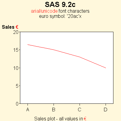

S0483680 CERTAIN UNICODE CHARACTERS (SUCH AS 'EURO') DO NOT WORK AS GPLOT SYMBOLS
S0491430 UNICODE CHARACTERS NOT APPEARING CORRECTLY IN CERTAIN CASES
SAS' new device=SVG graph output was available in V9.2c, but there have been several enhancements in V9.2p. For example, in V9.2c our dev=SVG handled html href= tags (for drilldown) and alt= tags (for mouse-over text), and in V9.2p we now also handle html title= tags for mouse-over text, and the des= option which allows you to add a mouse-over description for the entire graph.
Also, some web servers had problems serving our V9.2c SVG output because of inconsistencies in how web servers handle DTD (Document Type Definitions) at the beginning of the SVG file. Therefore we have removed the DTDs from our SVG output by default in V9.2p (and added an option to turn them back on if needed).
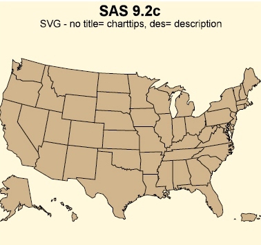

Note: SVG stands for Scalable Vector Graphics, and whereas GIF and PNG graphics area a "snapshot" don't look good if you resize them, SVG graphics are a set of instructions and the graphic is re-rendered each time you resize it (larger or smaller), and therefore the graphics look nice and sharp at any size. You will need a plug-in to view SVG graphics in the Internet Explorer browser, but some newer browsers (such as Firefox) come with built-in SVG viewing capabilities.
S0502096 SVG HONORS HTML ALT= CHARTTIPS, BUT NOT TITLE= CHARTTIPS
S0503412 SVG DOESN'T HONOR DES= OPTION (HTML 'ALT' TEXT CHARTTIP FOR ENTIRE GRAPH)
S0539674 CANNOT VIEW OUR SAS/GRAPH SVG OUTPUT ON SOME WEB SERVERS
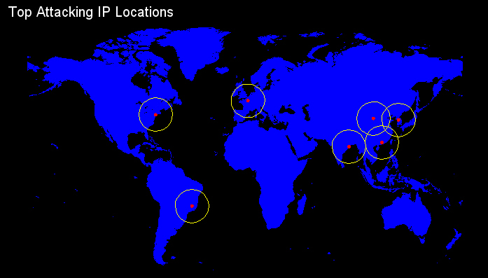
"Proc geocode" was originally released as 'pre-production' in V9.2c, and is now Production quality in V9.2p. Geocoding returns the longitude & latitude for a given address, and can be very useful in determining the location to plot colored markers on a map (for example, using SAS/Graph annotate). Currently "proc geocode" can resolve addresses down to the city and zipcode levels, and street-level geocoding is currently under development for a future release.
Additionally, "proc geocode" has a new capability in V9.2p - it can handle "dotted quad IP addresses" (for example, an IP address like 152.1.226.10) when geocoding against an IP address lookup table.
S0490256 REMOVE PRE-PRODUCTION NOTE FROM PROC GEOCODE LOG OUTPUT
S0490026 ADD DOTTED QUAD IP ADDRESS SUPPORT TO RANGE GEOCODING
In the past, SAS seldom updated the SASHELP.ZIPCODE sample dataset. These days, since this data is used for important things like "geocoding" (proc geocode), and since the world is changing at an ever-increasing rate and the US Postal Service frequently re-assigns zipcodes, etc ... we try to keep the SASHELP.ZIPCODE file updated much more frequently. In SAS V9.2p, we ship a snapshot of the zipcode data from April 2008 (whereas V9.2c contained July 2007 zipcode data). See the dataset label, for example, in the title bar along the top edge of 'viewtable', to see the date of your sashelp.zipcode data, as shown in the V9.2c and V9.2p screen-captures below:
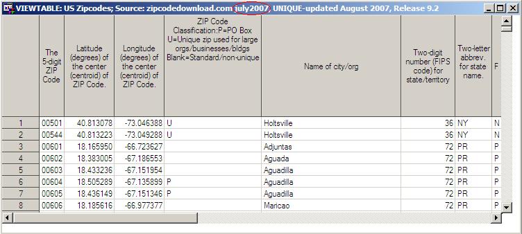

Also, you can always check our 'mapsonline' website to see if there is a more recent version available:
SAS MapsOnline zipcode download pageAnd one small change in V9.2p -- the PRS (parcel return service) zipcodes were removed from SASHELP.ZIPCODE.
S0515541 SASHELP.ZIPCODE UPDATE
S0517923 PRS (PARCEL RETURN SERVICE) ZIPCODES WERE REMOVED FROM SASHELP.ZIPCODE
In V9.2p, several of the SAS/Graph maps have been updated. Not only have some of the borders moved, and areas split or combined, but also the regions have been renumbered (ie, they have different "id" numbers now). Therefore, if you have old response data (such as population, sales, etc) that you were plotting on the old map, you'll need to update the "id" numbers in your data to correspond to your new map, or continue using the old (pre-v9.2p) SAS/Graph map datasets with your old response data -- otherwise, you'll be plotting the wrong data on the wrong map areas, which will cause "data integrity" problems in your maps!
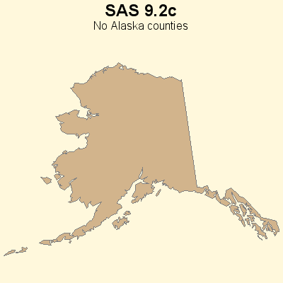
US County Maps (Alaska): Previously, the SAS/Graph maps.uscounty and maps.county map datasets did not show county outlines for Alaska (because Alaska does not technically have "counties"). Starting in V9.2p, the Alaska county-equivalents ("boroughs") are shown in the county maps.
S0492656 ADD COUNTY BOUNDARIES TO ALASKA IN MAPS.USCOUNTY AND MAPS.COUNTY

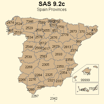
Updated Spain Map: V9.2c maps.spain had incorrect province numbers, which were updated in V9.2p:
S0515544 INCORRECT PROVINCE NUMBERS IN SPAIN AND SPAIN2 DATASETS

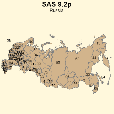
Updated Russia Map: There have been many changes to the regions making up Russia, which are reflected in the new V9.2p maps.russia:
S0476035 NEED TO UPDATE MAP DATA SETS FOR RUSSIA

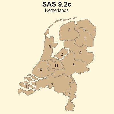
Updated Netherlands Map: maps.ntlands was updated to change a piece of Overijssel to be part of Flevoland.
S0522820 NTLANDS (Netherlands) DATA SET NEEDS TO BE UPDATED

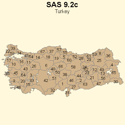
Updated Turkey Map: In V9.2c maps.turkey had 67 provinces, and in V9.2p it has 81 provinces:
S0382890 MAP OF TURKEY HAS 67 PROVINCES, IT SHOULD HAVE 81 PROVINCES
